
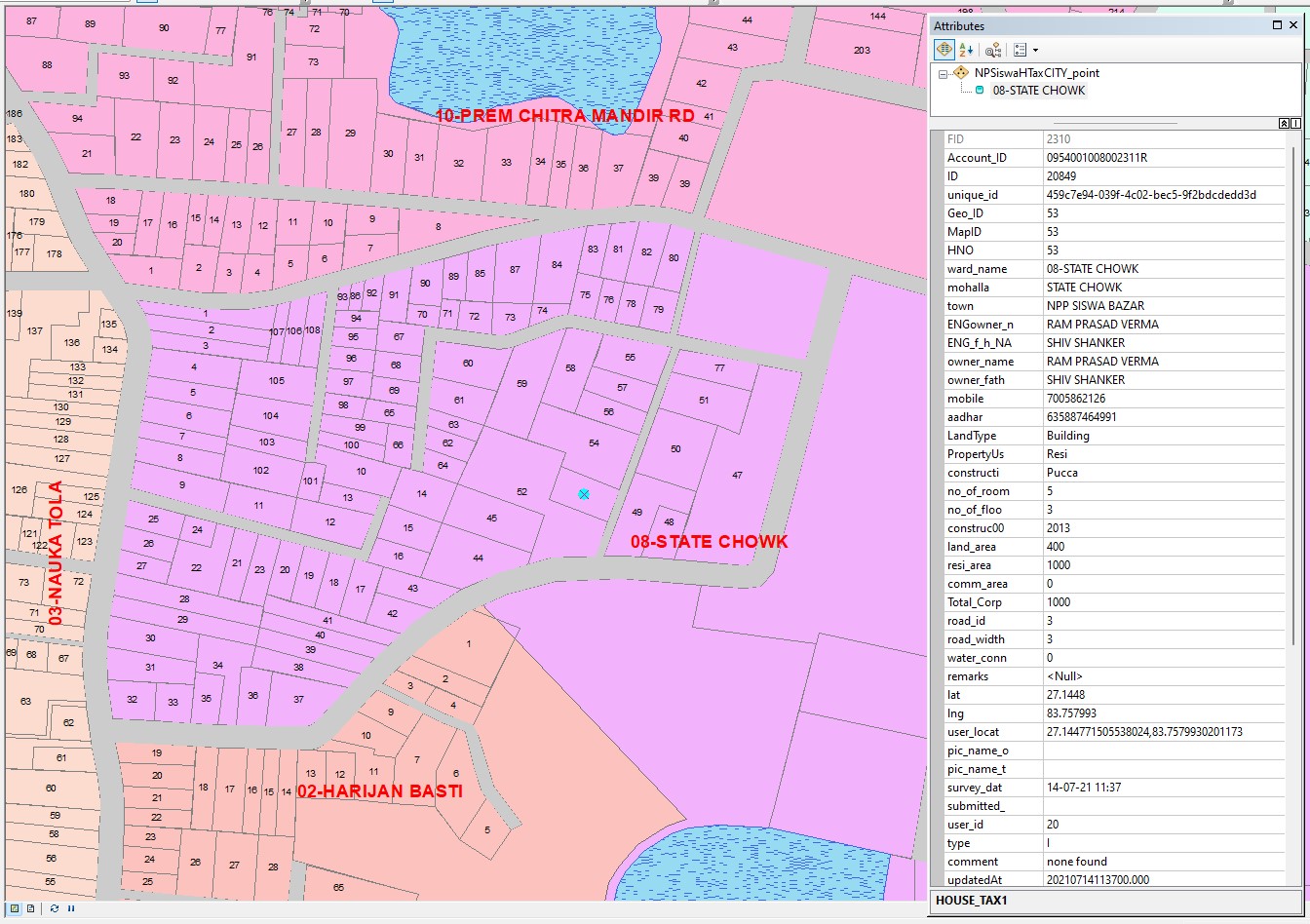
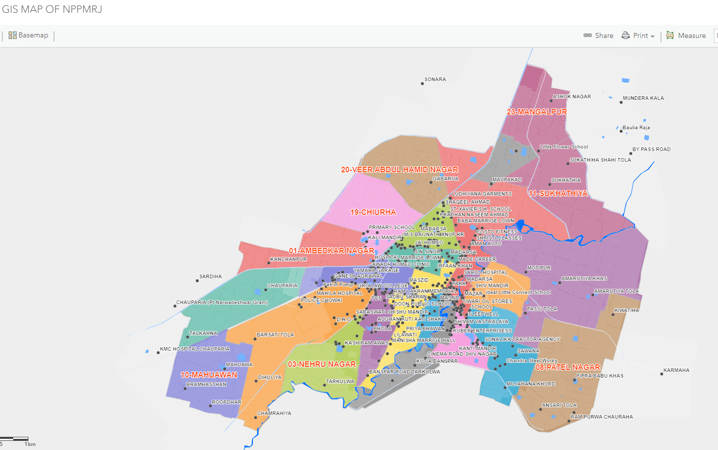
Live Web GIS Explorer is revolutionizing how towns and wards visualize, manage, and interact with spatial data. This cutting-edge platform offers real-time access to detailed geographic information, allowing municipal authorities and citizens to explore properties, infrastructure, and services across every ward with pinpoint accuracy.
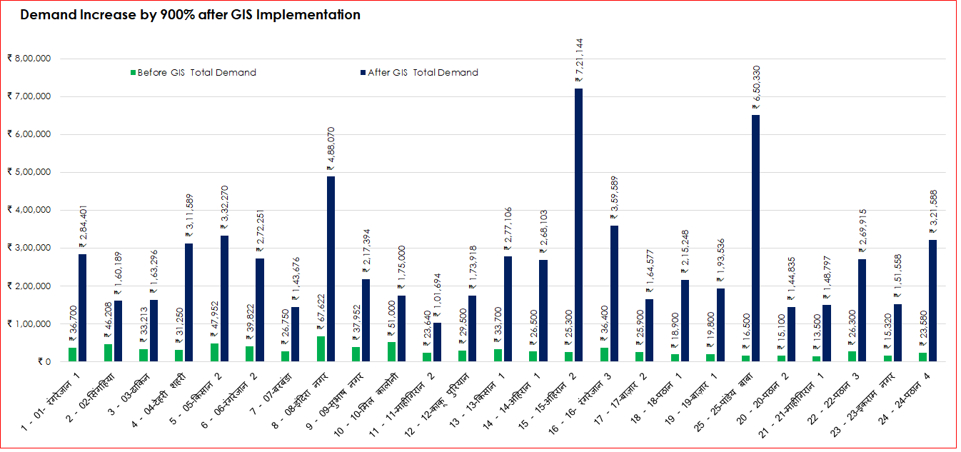
From tracking property boundaries and vacant lands to monitoring urban development and utilities, the system brings unmatched transparency and efficiency. Ward-level data can be viewed instantly, enabling faster decision-making and improved planning. Local officials now have the tools to assess demand, manage resources, and enhance service delivery—all from a centralized, web-based interface.
For citizens, the platform offers easy access to information such as property ownership, tax status, and ward-wise development projects. The Live Web GIS Explorer empowers communities by putting valuable data at their fingertips, promoting accountability and public engagement.
This innovation marks a major step toward smarter, data-driven governance—making towns and wards more connected, efficient, and future-ready.


Share This News