The GIS-based Ward Mapping, Property Survey, and Tax Implementation Project began in 2021 in Nagar Palika Parishad (NPP) Maharajganj, marking a transformative step toward digital urban management. The groundwork for a computerized mapping system was laid with full collaboration from municipal staff, establishing a powerful and evolving GIS infrastructure.
As the city experienced rapid growth, NPP Maharajganj expanded its GIS program to meet the evolving needs of urban planning and service delivery. Today, the municipality seamlessly accesses web-based GIS maps and built asset data, significantly enhancing operational efficiency.
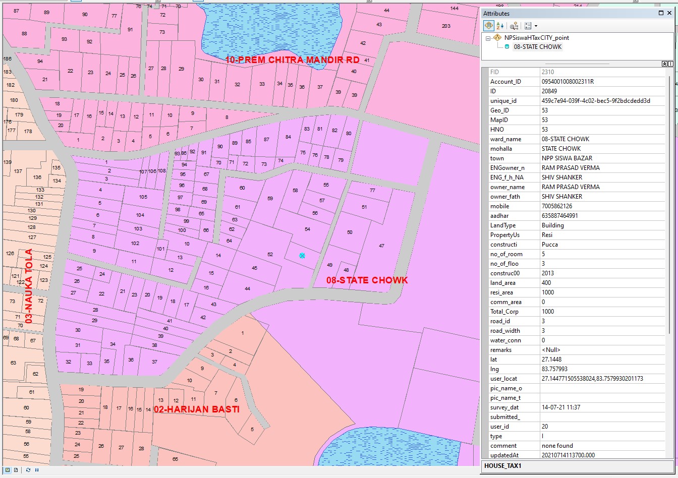
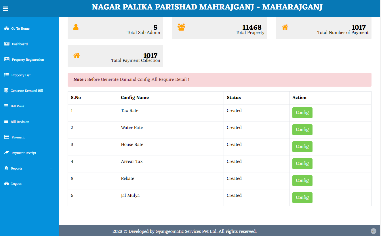
To ensure accurate property taxation and identify unregistered or tax-evading properties, the Uttar Pradesh Government entrusted us with conducting GIS mapping, surveys, and property taxation in various urban local bodies (ULBs), including:
Nagar Palika Parishads: Palia Kalan, Maharajganj, Siswa Bazar, Mishrit Namisharanya
Nagar Panchayats: Ramsanehighat, Belhara, Sidhauli, Chowk, Subeha, Banki, and more
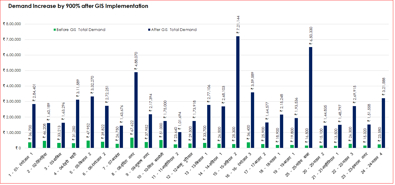
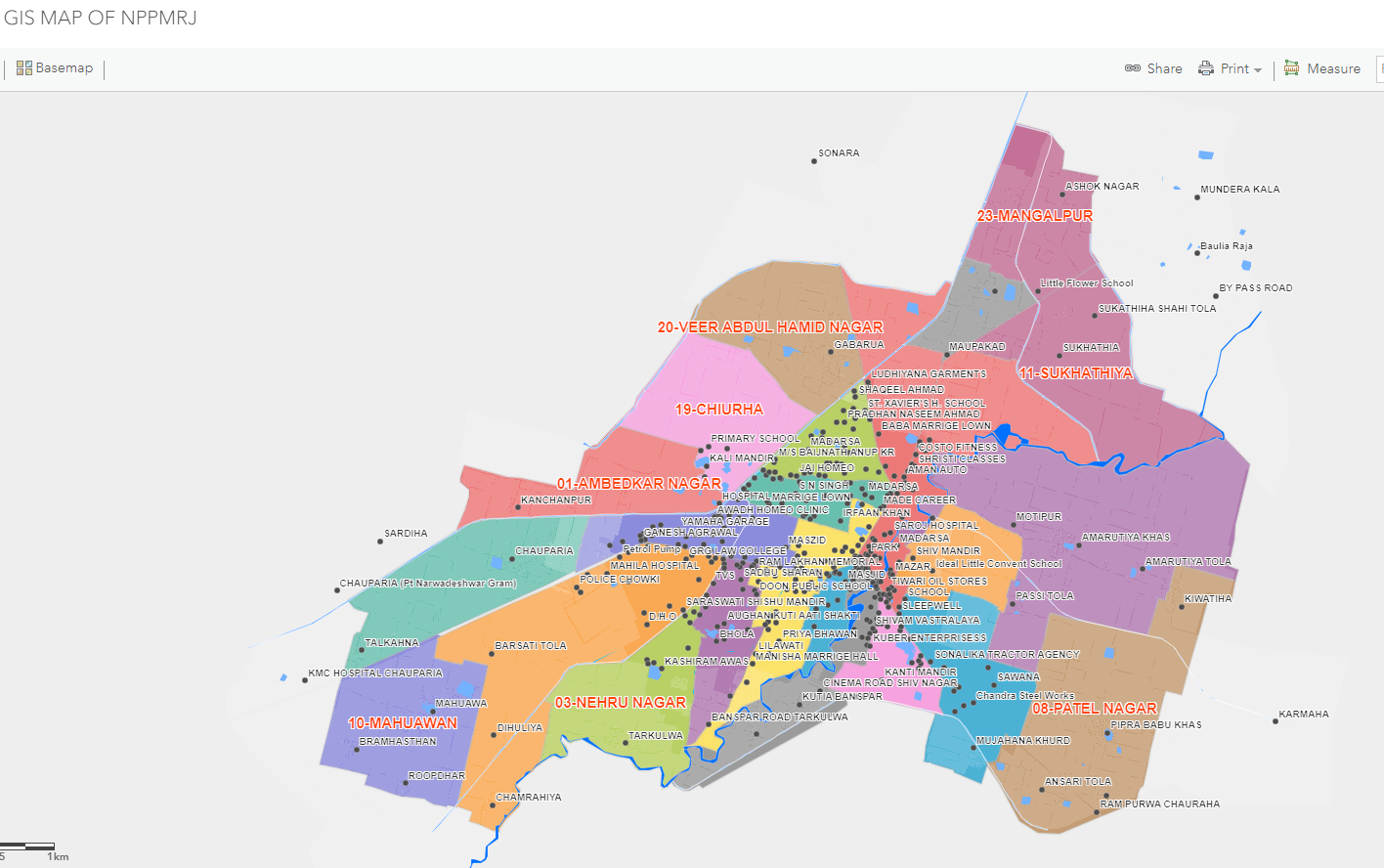
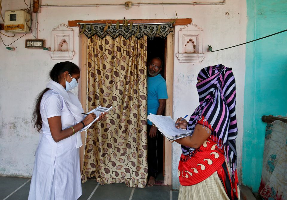
A comprehensive GIS-based survey of all properties within these ULBs is set to begin by the end of September. This initiative will create a robust, location-based property database, ensuring transparency and improved tax collection.
According to 2023 records, the total number of registered properties across these towns stands at 2.80 lakh, with many more expected to be identified through this initiative.


Share This News